
⚡ Overnight Chaos in West Michigan
A wild night of severe weather rocked West Michigan Thursday, bringing powerful winds, hail, and widespread power outages. Thunderstorms rolled in fast and furious, with winds blasting up to 70 mph and hail pounding rooftops and cars like popcorn in a microwave.
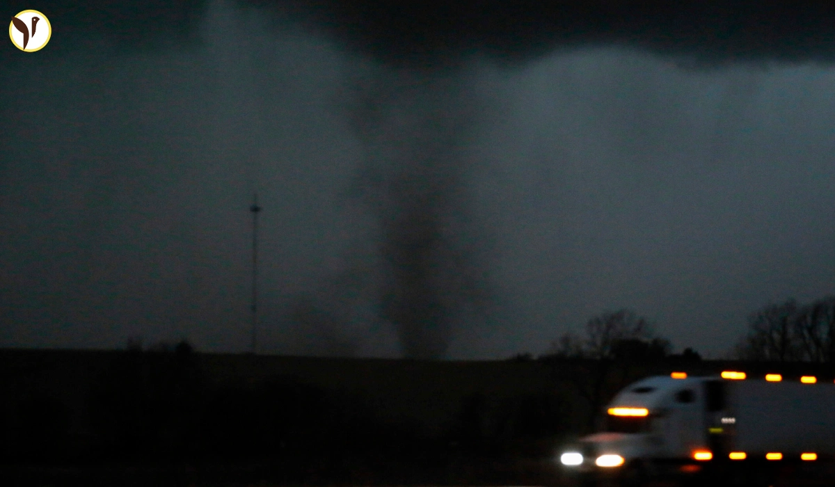
🌩️ From Minnesota to Chicago, No One Was Spared
This wasn’t just Michigan’s problem. The same storm system fired up dangerous weather across a huge chunk of the Midwest.
In Minnesota and Wisconsin, tornado warnings lit up the afternoon sky. Even downtown Minneapolis wasn’t spared, as sirens wailed and people rushed for shelter. Meanwhile, parts of Chicago braced for impact with an unusually high chance of tornadoes and record-setting heat that made things even more unstable.
It was a rare and intense weather day from the Twin Cities down to Lake Michigan, and everyone was on high alert.
💨 Why It Got So Bad, So Fast
This storm wasn’t your average spring shower. Here’s why it packed such a punch:
- It hit at night — the most dangerous time, when most people are asleep and might not hear warnings.
- It moved fast — giving people only minutes to react.
- It brought everything — tornadoes, high winds, large hail, and heavy rain.
- It fed on heat and humidity — Thursday’s record temps gave storms the fuel they needed to explode.
🛑 What You Can Do Next Time
Weather like this can strike with little warning. Here are a few tips to stay safe:
- Keep your phone charged and download a reliable weather alert app.
- Know your safe spot — a basement or windowless room on the lowest level.
- If you live in a mobile home, get to a safer place before storms arrive.
- Keep shoes, a flashlight, and a helmet nearby — it could save your life.
- Stay calm and don’t ignore warnings — they’re issued for a reason.